Pages

Saturday, August 30, 2008

Sierra trip '08

(Precipice Lake, High Sierra Trail)

"Wow, that's a light pack you're carrying!" This was the common refrain on my three longish outings in the Sierras over the past couple of weeks. One guy followed up with "How do you SURVIVE?!" Glancing at his gargantuan backpack, I wondered the same of him.

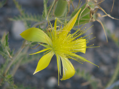
After warming up with Mt. Whitney, my first run took me over Pine Creek Pass, down to Hutchinson Meadow, through spectacular Humphrey's Basin, over Piute Pass and down to North Lake. The Bishop locals refer to this as the Sky Marathon. If *I* were a local, I could see doing this run over and over again. An interesting flower passed on the way up the Pine Creek Trail:
My second long run was the Evolution "100k," also known as North Lake to South Lake or the Evolution Loop. As is my experience with most Sierra trails, guidebook, trail sign, and map mileages rarely jibe, sometimes being off by miles. According to the Tom Harrison map, the Evolution Loop is about 54 miles; Bishop folks call it 60 and I would concur. (No way is it only 7 miles from Muir Pass down to Leconte & only 6.6 miles from there up to Bishop Pass!) Most people take about a week to backpack the loop, but why schlep all that gear when you can traverse it in well under a day? :) (I actually ran only about 5% of it; the rest was fast walking.) As is said with the Hardrock 100, you haven't truly "Evolved" until you've done it both ways, so I may have to go back and do it in reverse...

Finally, I fastpacked the ~70-mile High Sierra Trail in two days, going from Whitney Portal to Crescent Meadow in Sequoia National Park (east to west), total on-trail time about 25 hours. (Surely it can and has been run a lot faster, but I wanted to see the whole trail in daylight.) This trail is awesome!, especially the western half starting at Kaweah Gap, where 20 miles or so have been blasted into the side of the mountain with precipitous 1000+ foot dropoffs. (Encountering a large rattling rattlesnake here was a bit unsettling). The HST certainly rivals any section of the John Muir Trail in beauty, and without question a luxuriant soak in Kern Hot Springs at the end of Day #1 positively influenced the fun-0-meter.

This fastpack was also an experiment in seeing how light I could go: I carried a sleeping bag, extra clothing, and plenty of food but no tent, pad, stove, or bear can (since I was spending the night at the hot springs, where there was a bear box). Sans water, my pack weighed less than my cat. Admittedly, Fillmore is a rather portly cat. The experiment proved successful: the benefits of comfort and, therefore, speed on the trail far outweighed any minor discomforts of sleeping on the ground under the stars and eating cold mashed potatoes for dinner!

Sierra legend Norman Clyde probably said it best: "The diversity of the scenery which the HST traverses is nothing short of marvelous. The greatest trees in the world, at least one of its most beautiful canyons, and the loftiest mountain in the continental US are indeed the major, but only a few of the many scenic attractions along the HST." This is the view looking back while ascending Kaweah Gap:

And a section of the blasted-out trail. For perspective, a human being would be a small dot in this photo.

I'll end this blog post with a sappy quote by John Muir:

"These beautiful days much enrich all my life. They do not exist as mere pictures... but they saturate themselves into every part of the body and live always."

Couple more MR photos

If you look closely, you can see climbers on the route. ^

Pretty flowers on the way up ^

Wednesday, August 20, 2008

Friday, August 8, 2008

RAINIER: To the top & all the way around :-)

The trip to Washington was a success: THIS year we not only left the parking lot... we summitted! Our team consisted of myself, Janine, John, Doug and Grant, long-distance runners all. My teammates were no lightweights: among other accomplishments, Janine and John are veterans of the Iditarod Extreme (44 days!). They and our fearless leader Doug have completed the Grand Slam of ultrarunning, and 18-year-old Grant is the new national 50-mile trail champ for his age division, having run the White River 50 miler just 2 days previously! Here we are about a mile into the ascent. The summit looks so close but is so far...
By happenstance we ran into some runner friends from back East -- Charlie, Vicki and Barb, who were descending from a day hike to Camp Muir. With Charlie crewing, Vicki and Barb had just run the Wonderland Trail in 3 days, news I was very happy to hear because now I knew it was, indeed, going to be passable for Chet and me -- yippee! Happy smiles all around:

Our weather was great so far, but the forecast called for a storm to move in sometime after midnight. Being accustomed to going all night long in our ultra endeavors, we decided that after setting up the tents and eating dinner at Camp Muir, we'd head for the summit around 5 p.m. Umm... sure... okay... I like doing things differently! Our route was the standard Disappointment Cleaver and the Ingraham Glacier. Open crevasses abounded, and the penitentes looked like something created by Seuss. Fortunately, the route is so well traveled that we had no trouble getting around them. That's Little Tahoma in the background.
I felt great until about 13,500, when the altitude hit like a brick wall. Misery loves company, and I had plenty of it, with both Doug and Grant suffering altitude sickness. Fortunately, I only felt like I was going to puke! However, we were so close and, although a bit breezy at the crater rim, the weather was holding so we kept on climbing. Finally, the real summit!
Heh, heh... T'was a bit dark, but we could see the lights of Seattle which was pretty cool, as was crossing the crater. The descent took forever, but we intentionally took our time over the steep, hard-frozen terrain. (Most parties descend after the snow has softened up in the sun.) Here's Little Tahoma again, this time just before sunrise! As we descended lower, angry looking clouds filled the sky, so we were really happy we'd decided to climb all night.
Upon reaching Camp Muir, I decided to just head on down to Paradise since it was daylight and I knew I wouldn't sleep anyway. So, basically I unintentionally ended up climbing Rainier as a "day hike," albeit a bit slower than the fellow who climbed it in under 5 hours earlier this summer. (O_O) After a couple of days of R&R in Ashford, my BC buddy Chet (curiously, unlike the South Park Canadians, his head does not come apart when he talks) ventured south of the border to traverse the Wonderland Trail with me in 3 days. On Day 1 we simultaneously second guessed our sanity in the cold drizzle while happily anticipating the adventure ahead. Here we are at the start in Longmire (note the speedy legs)!

We were impressed by the maintenance of the WT -- this, the trail that was deemed impassable after the November 2006 flooding! We found the trail to be in excellent shape, every major river crossing with a bridge, most of them seemingly rebuilt every year. The photo below was the most impressive, well engineered bridge; there was quite a bit of movement as one crossed it. Not evident by the photo, it's pretty high off the ground. People with a fear of heights would not be happy here!
Chris crewed us and had the tents set up and all our gear available at the end of each day, so all we carried were a few pounds in our Nathan packs. I carried only one bottle since there was water everywhere, most of which I drank untreated. (I do not necessarily recommend that you do the same, but this is my norm and I haven't gotten sick yet.) Chris ended up driving about twice the mileage we ran. This photo is the start of Day 2 at Mowich Lake. Yep, that's snow we're standing on. The Northwest got a lot of late snow this year, so we had fun glissading, slippin' and slidin' across snowfields. :)
We spent the second night at White River Campground. Due to the overcast, after 2 days and roughly 60 miles, we had yet to see the mountain! Finally on Day 3 we had sun and clear skies. The terrain and views were spectacular, with flower-filled alpine meadows, fun snowfields, marmots, and warmer temps. The third day made up for the first two and then some. :-)
The finish at Longmire on Sunday afternoon: 90'ish miles, 20,000'ish feet of climb and descent, and about 27'ish hours of total running time (not including sleep!).
And now the flowers. They were just lovely! Here's a small sampling. These are called avalanche lillies.

And this is beargrass. We saw *fields* of it, especially on the first day!
Not sure of the names of these, just like all the colors.
IMO, more beautiful than the finest of cultivated botanical gardens.
This is a tiger lily. Some plants have only one bloom while others have many. The most I've seen on one stem is 9 blooms.
Isn't he CUUUTE?! Compared to Colorado marmots, Washington's are generally lighter in color, blond almost. We also saw a few pikas, a deer, and just missed seeing a black bear.

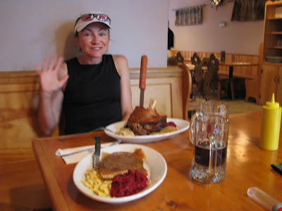
I was threatened with embarrassment worse than this photo if I didn't include it. Let's just say that after all those miles, I was feeling a bit protein deficient, so we took a jaunt up to my favorite "pretend we're in Bavaria" town -- that would be Leavenworth -- and dined on schnitzel, schweinhaxen, kraut (sauer and rot), and, of course, Spaten. Guten appetit!

Friday, July 25, 2008

Dog Daze

After the 4th in Illinois, we traveled to Houston for business. Yes, Texas. Yes, in JULY. Yes, it was hot, and no, I did not leave the hotel for 48 hours. It was hot. Did I already mention that? A humid, smothering, wet, oppressive, fantasize-about-living-in-a-meat-locker-kind-of-hot. I am accustomed to heat here in California, but there is very low humidity. I spent three days running on the hotel treadmills trying to not go completely berserk. Even with the AC, the humidity was crazy. No offense to my friends from Texas, but I have to say it's my least favorite state in the country... and I've been to all of 'em 'cept North Dakota! (To be fair, I have never been to Austin which is supposed to be pretty cool. Rocky Racoon is a great event, too.)

We then flew back to the paradise that is Chicago (anything is paradise after Houston in July) and spent the weekend in Whitewater, Wisconsin. The nearby Kettle Moraine State Forest, which plays host to both the Ice Age 50 and the KM 100, had some wicked nice trails. Because of excessive rain, the John Muir Trails were closed to mountain bikes so I had them all to myself and -- due to VERY hungry and aggressive mosquitoes -- I got in a fast-for-me 20 miler. BTW, who knew there was a John Muir Trail in the Midwest?!

Back in the Windy City, we checked out the Field Museum of Natural History, home of "Sue," the biggest and best T. Rex ever unearthed, named after the paleontologist who discovered her. I loved this colorful display:

A Sue Store -- woo hoo!! Yeah, so I went a little nuts there -- read the hat! Heh, heh... normally I wouldn't wear a hat that says "BITE ME," but all my running hats were dirty, it was sunny, and we had bought the hat at Joe's Crab Shack in Houston as a C2M giveaway. I got a few strange looks. ;-)

We were total tourons and did the Sears Tower thing. Although not the high point that counts, it IS higher than Charles Mound, so I had to do it. I wanted to run up the stairs, but we were required to take the elevator, and -- get this -- it took us only to the 103rd floor, and there are 110. The OC in me found this very lame indeed. Still, the view was pretty awesome:


The past week and a half we've been back in Oxnerd, so I've been running the trails in PMSP and Ojai. There are some great trails in Ojai -- C2M is there -- but MY GOD, it gets hot in the summer! (But it's a dry heat...) On a 13 miler the other day, I went through about 90 oz. of fluids, a full 70 oz. bladder and a handheld. Of interest, word is the mountain lion population is increasing up there. (O_O) I hope to see one... from a safe distance... one that has just eaten a big meal. :p How cool would that be?! Best I managed was a tarantula near Mugu Peak last weekend.

We are leaving for Washington State on Sunday. My good friend Doug is going to lead a small group of us on Mt. Rainier. Hopefully we'll get better weather than last year, when we couldn't even leave the parking lot! Also, my friend "Chet" (pictured with me below) and I are going to attempt to run the Wonderland Trail in three days. Chet just finished H'ardrock; hopefully he can keep up. :p We realize that due to all the snow the NW received this winter and spring, the WT may be a long shot -- this site doesn't sound very encouraging (pull down a little over halfway for WT) -- but we'll inquire at the ranger station as to the latest conditions and try to give it a go. Alternately, we may run the White River 50 course just for fun. No worries... Washington is a fun playground with spectacular trails and mountains, so there's no shortage of options. Gotta go pack now.........

Monday, July 7, 2008

4th of July in... Illinois??


That's right. A quirky alignment of the stars placed us in tiny Walnut, Illinois, for this year's 4th of July festivities. Walnut is about an hour east of the Quad Cities, an hour north of Peoria, and a couple hours west of Chicago -- in other words, in the middle of nowhere -- surrounded by corn, soybeans, quiet farm roads, and wonderfully friendly, down-to-Earth people. Walnut's Hometown Celebration stretched four days, with festivities ranging from the popular bean bag tourny to volleyball and softball games to the greased pig chase to the really popular beer garden (assuming you like Miller Lite, MGD, and Coors Light) and all manner of fried treats. Funnel cakes anyone? There was even a 5k road race Saturday morning in which yours truly finished second among the many hundreds of women entered. In fact, all five in our group walked away with hardware. :) In addition to the 5k, only my second ever and quite *painful* for one used to the comfortable pace of ultra-distance events!, I got in a couple of nice runs in the countryside. Sunday morning I was even out the door by 5:30 and got to witness a spectacular sunrise. THAT hasn't happened in a long time.
.
We then drove a couple hours north, almost to Wisconsin, in order to climb the high point of Illinois. Last month Denali; this month Charles Mound, elevation 1,227 feet! Interestingly, legal access to this high point is actually more difficult to attain than Denali. The land is privately owned, and the landowners open their property to highpointers only the first weekends of June, July, August, and September. They request that visitors park at the main road and walk a little over a mile up their beautiful lane to the summit, so at least it's a bit a of a hike and not just a driveup. Northwestern Illinois actually has tiny rolling green hills and looked more like my homestate of Vermont than what one would normally expect of Illinois. This is one of the reasons I love highpointing -- because it's brought me to places I otherwise would never have visited, and almost always I'm pleasantly surprised that the reality of a place usually surpasses my expectations.
.
While Charles Mound is the geographical high point -- and the one that "counts" -- the Sears Tower is actually higher at 1,451 feet, the antenna at 1,730 feet, sooo... when we're back in Chicago next week, think I'll bag the Sears Tower. (I would love to take the stairs but think I'll have to settle for the elevator with all the tourists.) It will be neat to have done both high points of my birthstate. :)

Finally, the above photo is the dregs of some of the best fried chicken I've ever eaten. The place is called "Rips" and is in Ladd, IL. The wait is long -- our group stood in line Friday night almost 90 minutes; however, the bar is open while you wait. Your choices are chicken (light or dark) and fish (light or dark), all deep fried. I had both chicken (dark) and fish (light). No matter what you order, you get a mound of fries with a piece of white bread at the bottom of the plate. The vegetable is mushrooms, breaded and deep fried of course, and the appetizer is "crumbs," the small pieces of fried batter that have fallen off the chicken and fish. To offset the grease, you are given a bowl of sliced pickles. Everyone eats with their hands; if you want a fork, you have to ask for it. Although sorely tempted, I held back from buying their "GREASE ME UP!" T-shirt. More here.

Tuesday, July 1, 2008

Quick trip home

Last week I squeezed in a quick trip to New England to visit my folks in Northern Vermont and my beloved White Mtns. in neighboring New Hampshire. The visit was all too short, but I managed a *wicked awesome* hike up Cannon Mtn., one of my favorite running routes--a rolling 8 miler on the quiet back roads of Barnet and Peacham, and a nice visit with my ex and our dog.

My parents fed me well: BBQ chicken (by request) the first night, pancakes with real maple syrup (well duh), and yummy baked ziti the second night. So nice to be home and hard to leave the beautiful place that is Vermont in June.

Best dog in the world:

I've been getting in a lot of running miles the past couple of weeks. Three weeks of zero running miles in Alaska, then weeks of 75 and 60. Likely a coach would not approve; good thing I don't have one. :) For me, these are big weeks; even when I was racing a lot, I rarely got in more than 30-40 miles/week. It has been HOT, even here on the coast ("but it's a dry heat"), and because I am not a morning person, I get to feel the full brunt of the midday heat, quite the contrast to the subzero conditions of a month ago. Not complaining though--I feel great and like the heat!
On Thursday we embark on the next big mountain expedition: the high point of Illinois. Charles Mound, here we come! Preceding that will be the Fourth of July celebration in... drum roll... WALNUT, ILLINOIS!

Wednesday, June 18, 2008

San Joe-Zee

(No,that's not Kansas. It's J.D. Grant Park, near San Jose.)

Chris had a business trip in SJ this week, and we flew up on Saturday in order to visit friends Ann and Wayne. Ann has a most *amazing* wine cellar, and along with Lisa and John, we imbibed in a couple of California chardonnays, three French bourgognes--1979, 1982, and 1986 vintages!--and two sweet dessert wines, sorry I can't be more specific. If that wasn't enough, Ann served a scrumptious five-course dinner as well! Had to have some food to go with all that wine!
.
On Sunday I was feeling completely and totally unmotivated to run or exert myself in any way after so much wine the night before, so we DROVE up Mt. Diablo (trying to avoid all the road bikers) and walked the nature trail loop around the summit. Hah! I did pick up a map so will be ready to hit the trails next visit, many miles there!
.
I love visiting the Bay Area with its abundance of trails and open-space parks. One of my favorites so far is J.D. Grant. Only 20 minutes east of the city, up the narrow and winding Mt. Hamilton Road, this park has been almost deserted every time I've been there. Except for the sound of airplanes, it is also a very quiet place and one with lots of wildlife. In a 15-mile run, I saw a coyote, lots of birds of prey, a bunch of wild pigs, a deer, and about 3 trillion comical ground squirrels. :)
.
Tuesday I got in about 14 miles and 4000 ft. of vertical on and around Mission Peak, always a good climb and workout, and on Wednesday a quick 8 miler on the New Almaden Trail (reminiscent of the Wildwood Trail in Portland in the way it weaved in and out of the terrain's curves) in Almaden Quicksilver Park, new terrain for me. Tuesday night we had dinner and more good wine with our friends the uber-cool Zombies and got to see their awesome new *retail store* in Palo Alto (opening later this summer). We wish them continued success!!
.
Flew back to Santa Barbara Wednesday night (SO much more of an enjoyable airport than nasty LAX!), with a spectacular full moon over the ocean to enjoy on the drive home on PCH. :) Home for a few days, then over to the Right Coast early next week...

Friday, June 13, 2008

Post Denali ponderings, Part II

I decided against doing another day-by-day account of our Denali trip since the West Buttress route is so well known, traveled, and documented, AND since Mats is doing such a good job over on VFTT. (Another of our team members, Arm, has posted 100+ nice photos!)

After weighing our gear for the flight out of Talkeetna and coming to the astonishing conclusion that we averaged about 117 lbs.!! per person (although mine was more in the 100 lb. range), I commented that my JMT speed hike pack weighed in at 4 lbs. at the start. This prompted a sort of compare-and-contrast between climbing Denali via the WB and blitzing the JMT. While on my run today, I got a little carried away with it. Here goes--JMT first, then Denali (some numbers are educated estimates):

Total miles hiked: 223 / 38
Average miles per day: 58 / 2.7
Total elevation gain, in feet: 38,000 / 18,000
High point reached: 14,505 / 19,918
Highest pass: Forester 13,153 / Denali 18,200
Demigod: John Muir (duh) / Bradford Washburn
Miles hiked in the dark: Many / 0--it was light all the time!

Partners in crime: 2--crew Chris & Deborah / 7--Frodo, Lloyd, Arm, Garret, Jeff, Mats, & Rob
Time spent in tent: Not nearly enough / Way too much
Surface: Dirt, rock, kitty litter-pumice / Snow & ice
Footwear: Montrail Hardrocks 13 oz. each / La Sportiva Nuptse mountaineering boots 3 lbs. each, MSR snowshoes, Black Diamond crampons, OR overboots up high
Gaiters: Dirty Girls, short / Mountain Hardware, high
Pack: Nathan Intensity / North Face Snow Leopard, circa early 90s (& child's sled low on mtn.)
Average daytime temp: Pleasant (60-70s) / Cold (0-10s)
Layers of clothing: 1 / 5, including down jacket at 19,000 ft.
Painkillers taken: 8 Tylenol / None
Sunscreen: Lots on 80% of body / Lots on 5% of body (face only)
Days without shower: 3 / 14
Food: Mary Jane's Farm pastas, spuds, oatmeal, Snickers bars, jerky, nuts, salami / Same
Java: Starbucks Doubleshots / Folgers instant (possibly the most significant hardship of the trip)
Water: Plenty / Plenty (just had to melt a boatload of snow in order to get it)
Poop: WAG bags in Whitney Zone / Clean Mtn. Cans on entire route
Permits: $15 (for the Mt. Whitney Trail) / $200 per person
Favorite sections: Rae Lakes, Pinchot Pass, Evolution Valley / Fairview Inn, Talkeetna :)
Most adrenaline producing: Climbing Half Dome on reconnaisance hike / Flying to the Kahiltna Glacier, climbing the fixed ropes, traversing the 16 ridge, climbing to Denali Pass unroped, descending Denali Pass roped (i.e. like everything above 14,000 ft.)
Least favorite part: Lyell Canyon / Trying to sleep at 17,200 feet
Best campsite: Lower Evolution Valley / 14,000 ft. Basin Camp (when the sun was out)
Jumping-off town: Lone Pine, CA / Talkeetna, AK
Funny place names: Tully Hole, Bubb's Creek, Happy Isles / Motorcycle Hill, Squirrel Point, Washburn's Thumb, Pig Hill
Crowd factor: High / High
Foreigners: A handful / Many
Quizzical comments: "Well, aren't YOU adventurous?!" / "I DON'T KNOW!" (Hong Kong climbers' response to every question)
Flora seen: Lots / A tiny bit of lichen
Fauna: Lots--birds, marmots, pikas, deer / 1 Raven (Talkeetna population omitted from count)
Fuel: One 8 oz. isobutane canister / 10 gallons Coleman
and finally...
Pack weight:

Saturday, June 7, 2008

Post Denali ponderings

Home again safe & sound with all digits intact after a fab 17 days in Alaska with Team Dom, pictured below at the 14,000 foot camp! That's top row Bob aka Frodo, Lloyd, Garrett, and bottom row moi, Rob, Jeff, and Mats (he's not an albino--that's sunscreen on his face). Team member #8, Arm, is missing because he took the photo.


Having landed at LAX just this morning after a red eye from ANC, I'm still processing all the fun--and it WAS fun in an extreme, masochistic (read: I-can-go-two-whole-weeks-without-a-shower!!) sense (and yes, I did actually "wash" my hair with Arm's hand sanitizer and a liter of water one day). I'm contemplating whether to write up a sort of sole-female, novice day-by-day account or whether to leave it in executive summary form. For now, will opt for the latter.

BTW, for those who were fooled, the previous two posts were ghostwritten by a certain jokester we'll call "Chris," but the facts are almost completely accurate. We did have a marginally functioning sat phone complete with 3 lb. (?) solar panel but no Blackberry, Gooseberry, or Dingleberry... two plus weeks without internet--oh my!

Our team public affairs director and eternal optimist, Mats the Swede, is in the process of posting a day-by-day summary on the northeastern US hiking website Views From the Top. (Click on Trip Reports, then "Team Dom Denali Attempt Day by Day.")

As previously mentioned by my ghostwriter, we lucked out and were able to fly onto the Kahiltna glacier late on Thursday, May 22, and over the next week and a half gradually made our way up the mountain to a high camp of 17,200 ft., where we spent three restless nights, punctuated by the panic-provoking sensation of trying to breathe with plastic bags over our heads. This lovely piece of real estate was preceded by 10,000 vertical feet of sled hauling, fixed rope ascending, eye-popping/leg-vibrating, multi-thousand foot sure death-inducing dropoffs, subzero temps, waaay too many hours in the tents, mastering the pee bottle, and getting to answer the call of nature with the aid of Clean Mountain Cans. Damn, but THAT was fun! The guys were chivalrous enough to never demand that *I* carry the contents to the nearest crevasse. Eww. (Why yes, as a matter of fact, I CAN "be" female when it is of personal benefit.)

On Monday, June 2, all eight of us started for the summit. One of our unfortunate compatriots who was suffering from altitude sickness turned back at 18,200 feet as did our fearless team leader who opted to accompany him. (He'd already summitted in 2004.) Another of our members decided to take off solo; he did summit. The remaining five, of whom finishing as a team was paramount, stuck together, maintaining the pace of the slowest member. Alas, the weather turned on us before we could achieve our goal--it was nasty indeed, w/~30-40 mph (?) blowing snow and subzero temps--necessitating our turning back at the 19,900 foot level, approximately 400 feet below the summit. The trek back "home" bordered on Epic, with none less than five self/group roped arrests on the infamous Denali Pass/Autobahn/most deadly section of the route requiring about three hours to traverse a mile. Needless to say, it was a night *I* will not soon forget.

(O_O)

Although we still had a few days to spare, we unanimously agreed to get the flog off the mountain and retreat to the outpost of Talkeetna to eat real food, drink beer, and hang out with like-minded fringe elements of society. If you are ever in the neighborhood, don't miss the historic Fairview!! :-) With heavy hearts, our Alaskan escape from reality was over all too soon as we retired to Anchorage and our respective flights home.

Here are a couple of shots, with more to follow...

My tentmates-turned-bros, team leader Frodo and snow melter extraordinaire (and soon-to-be new dad!) Lloyd:


Steep section of trail heading up the West Buttress headwall. Just above this point it gets really steep, necessitating the use of fixed ropes and ascenders.
Gotta go... for my first run in 3 weeks!

Saturday, May 31, 2008

PR for Elevation -- wooHOO!!

OK, no more foliage schlepped in by our local NPS buddies. Just lots of... oh, what is this white stuff all around us? sounds like... "though"... "thno"... oh, dang, must be the diminishing brain function!!

Big thrill of the day -- washed my hair for the first time since we landed on the snow!! I wonder if Pantene will give me a promo spot on some future TV ad...

We ventured ever higher today, some of us to 16,200 (my PR to that point), others to 17,200 to stash that single malt scotch. Ascending The Wall (the last 800 ft of vertical climb on fixed rope just before 16,200 camp) caught my breath more than a couple times! We all re-grouped at 14,200, and we may try to creep back up to 17,200 today to take advantage of good weather. (It was so warm today, I donned my running hat and tried to get some tan on my arms -- looks like I'm having fun, doesn't it?) The forecast looks good for the next few days, so we'll likely dig up some motivation to summit while conditions are favorable. Of course, the higher we go, the heavier the task of moving expeditiously, but we won't know the full challenge until we start up again. The final objective, of course, being to get back down safely and happy for having at least taken on the trek.

Most likely, won't be able to post again until we're back down to the NPS Oasis at 14,200. Boy, the hot springs behind the NPS tent sure will be a treat!! Sure hope we get back before Happy Hour closes...

Thursday, May 29, 2008

Glad Tidings from the Glacier?

Yup, that's me at 14,200' -- we got the local NPS folks to bring in some foliage, just so we didn't feel like we were too far above treeline. Almost like being back in VT...? After the first couple days of organizing (read, re-packing) and getting our trek brief from the NPS guys in Talkeetna, we all loaded onto a single plane for Kahiltna base camp at 7800 feet. Gear? About 117 lbs average weight among the eight of us!! And not a sled dog and rig in sight -- bummer!

We had a spot of bad weather for a couple days over the weekend, further exacerbated by a finicky satellite phone that made communication with the lower 48 very frustrating. But in the last couple days, the sky has been pretty clear with temperatures ranging between 50-75 degrees. (Were that the case, the newly gaping crevasses would likely swallow us all up, or we'd have a heckuva ride sliding on our backsides off the mountain. For now, I can only long for sitting by the side of PCH soaking up the rays and feeling the ocean breeze on my cheek.)

We've moved methodically from 7800' thru camp at 10,500' and on to 14,200', which seems to serve as primary base camp for most groups. While we rested today (still acclimating), tomorrow we hope to push to 17,200 to drop off some provisions, then back here at 14,200 to camp another night or two. Then, hopefully, if Wally Weather cooperates, we could summit early next week. Maybe we'll be loving life so much we'll just want to camp on the summit and greet the next couple days' climbers with our endless stock of single malt scotch. Yes, hallucinations and brain ramblings apparently are common at altitude...

Will try to post again in a few days. Brought to you today from my Gooseberry Hyper-GPS Dual Action Coffee Brewer / Tootsie Warmer. Oh, the weather outside is frightful, but the...la-de-da-de-da-da -- feel free to finish the tune for me...

Wednesday, May 21, 2008

Anchorage!!

(won't see one of these in awhile...)

A quick post on the hotel computer in the lobby.

Most of our team arrived in Anchorage last night and congregated at the Long House Hotel. Looking out the airplane window for the last hour or so before landing, the mountains were stunningly, incredibly, awesomely, and spectacularly beautiful: peaks and whiteness as far as the eye could see!! Upon landing, although my watch said it was evening, that wasn't evident at all by the brightness of the sky. The sun finally went down around 11 or 12, I think, then rose again just a few hours later. After a good night's sleep, we spent the morning shopping for last-minute gear, food and spirits for our little adventure.

We are awaiting the arrival of Bob and Jeff shortly. We'll spend another night here at the Long House, then leave for Talkeetna at 8 a.m. After the mandatory NPS check-in, we are hoping to luck out and get flown onto the glacier tomorrow (Thursday) afternoon, weather dependent of course.

We are excited and ready to climb the mountain if she'll let us. :)

Monday, May 19, 2008

And we're off!!

Our "press release" written by team member Mats...

Team Dom:
Bob Williams, MA
Garret Oswald, ME
Lloyd Graves, MA
Armand Turcotte, NH
Sue Johnston, CA by way of VT
Jeff Stone, MA
Rob Kettels, Australia
Mats Roing, MA by way of Sweden

The team name is chosen in memory of friend Neil's son Dominic who's life was tragically shortened by an avalanche in Lake Louise, Canada, in January 2008. We will be attempting to carry Dominic's ice axe to the summit. Though Dom can't be with us physically, we will be bringing him along in both spirit and in memory... We are going unguided, which caused us to spend the past 6 months planning out every little detail from what air service to use to how many wands to bring, but we are ready to go.

We were originally ten members but Charles Steele from Michigan had to undergo surgery and cannot participate. And recently Thom Davis (Dr. D) had to withdraw due to a hip injury. The West Buttress Route is our choice of route and it's the "normal route" up the mountain.

Training has been going well through the winter and spring with both technical and physical training. The White Mountains and Baxter State Park in winter make for some excellent Denali training. Several members of the team also spent 3 days training on Mt. Shasta in April. Rob Kettels have been training a lot in the New Zealand Alps in the last year including a summit of Mt. Cook, the tallest peak in NZ. Rob Kettels is the only team member without White Mountain experience. He and Mats summited Aconcagua in 2006. He has also Elbrus and Mont Blanc under his belt among other peaks.

We will have a satellite phone so our loved ones will be periodically updated with our progress. Looking forward to the see you all again when we’ll get back and the goal is to celebrate that everyone gets back alive and well. Summiting is a subordinate goal.

Team Dom

(Note: Chris plans to post updates to my blog periodically in my absence. I am scheduled to return to the land of fruit and nuts on June 11.)

"Nobody climbs mountains for scientific reasons.......you really climb for the hell of it."
Sir Edmund Hillary

Sunday, May 18, 2008

Neighbor & Chickety

My hiking buds from back East, Neighbor and Chickety, are 400+ miles and a month into their PCT thru-hike and having a blast. Saturday afternoon we drove over to the hiker hostel in Agua Dulce to see them as well as a bunch of their fellow PCT'ers, this group being the beginning of the main 2008 wave. The temperature hovered around the 100 degree mark, and these guys get to traverse the Mojave desert next. Gosh, what fun! I brought them some Nuun and Saltstick caps--heehee--and we drank frozen margaritas. What a contrast that in a few short days I will be playing in the snow on the Kahiltna Glacier. :-)

Chickety is keeping a blog of their trek here.

Thursday, May 15, 2008

On the subject of COLD...

It probably comes as no surprise that Denali has occupied my thoughts of late(!). I've come to realize that as much of the preparation involves getting one's head in the right place as it does going through and procuring gear, checking and rechecking lists, buying and organizing food, etc.

During my run this morning, I spent some time thinking about cold -- that is, the times in my life I've been coldest. Certain very cold hikes come to mind. When I lived in Northern Vermont, I'd spend the majority of winter weekends climbing peaks in the White Mtns. of New Hampshire, eventually climbing all 48 of the 4000 footers in every month of the year as well as the New England 100 highest peaks in calendar winter (12/21 to 3/21 +/- a day).

I remember one particular 15-mile hike when the temperature was in the minus 25 to 30 degree range and my partner and I wore face masks nearly the entire day. (Were we stupid or what?!) On a hike to Mt. Isolation which is a spur ridge off Mt. Washington, another 15 miler, the high for the day was minus 15. Stopping to eat or drink was difficult at best. At one point my hands were so cold that my best friend had to zip up my hood for me. The other very cold hiking experience that came to mind this morning was my first winter trip to Baxter State Park in Maine. Instead of opting for the heated (wood stoves) cabins, our group decided to tent camp. We knew it was very cold when the trees started popping and cracking. My thermometer read 18 below. On future trips, we stayed in the warm cabins!

While these experiences were cold ones, they weren't scary because we were prepared with multiple layers of clothing, chemical hand warmers, etc. Interestingly, two of three times I was so cold to the point of being very afraid were during long runs.

The first was during my thru-hike of the Appalachian Trail back in the mid 90s. It was early August in Maine (heat, humidity, and bugs come to mind, right?), and I'd sent much of my warm layers home. On the day my trail friend and I crossed the spectacular above-treeline-for-many-miles Saddleback Mtn., there was a steady drizzle, winds probably in the 20 mph range, and a temperature drop to the high 40s. Again, stopping to eat was out of the question. We wore all our clothing, walked as fast as we could (being conditioned thru-hikers, that was pretty fast) and arrived at Spaulding Mtn. Leanto in late afternoon chilled to the bone. I'll never forget my friend's kindness in taking care of me that night (hi NM!!), providing hot drinks and my trail staple, Lipton noodles!, until my hands worked again.

The second incident was during the March 2000 version of the then annual Horton & Co. one-day ~70-mile run of the AT through Smoky Mtn. National Park. Being runners, the six of us wanted to go fast and light. David was unable to cajole anyone into crewing for us that year (there is exactly ONE road crossing where crewing is possible), so we were completely on our own for the entire 20+ hours. Although bailing out was an option at the road crossing, it would have involved a very long, convoluted hitchhike back to our vehicle at the north end of the park boundary. About a third of the way into the run it started to rain. As we approached Clingman's Dome, the rain had turned to snow and the wind picked up. We were wearing all the clothing we'd brought and trying to move faster to generate body heat. It was a scary situation, one where if someone had broken a leg, they probably would've died. As with any story, there is, of course, a little more to the story, but what happens on the trail, stays on the trail... :) The snow and rain eventually stopped and we warmed up, but the adventure was not yet over: about 5 miles from the end, I tripped and broke two ribs on sharp rock! The stupidness here is that I returned the following March to do it all again...

The final OhMyGodIMightDieOfHypothermia story was when Steve & Deb Pero, Greg "Loomdog" Loomis, and I ran the 54-mile Monadnock-Sunapee Greenway in New Hampshire one April day. We were doing great, moving along fine, talking, laughing, and having a great time when, about two thirds of the way through the run, it started to rain, the temperature dropped, the wind picked up, and the rock ledges (of which there were many) were encased in a layer of ice. Once again wearing every item of clothing we'd brought and getting VERY cold, we struggled to move quickly so as to generate body heat. When Steve stopped talking, I got very scared. Our margin of error was zero. Long story short, we made it to my VW Golf parked at Sunapee Ski Area amazed (at least I was) to be alive. Thereafter this run became known as "The Death Run."

Now you know why I moved to Southern California. :) Gotta run..............!

Tuesday, May 6, 2008

Denali links

Doug sent me some cool links today -- thanks Doug! :)

This photo is of the West Buttress route up Denali. The West Butt is the easiest and the most climbed route on the mountain. Still, the success rate is only about 50 percent. Talkeetna Air will drop us off on the glacier near Base Camp. Our team leader, my friend Bob who summitted Denali in 2004, reports the flight through One-Shot Pass to be one of the scariest aspects of the whole endeavor.

A couple of inspirational photos here and here. Here are the upper route and the final push to the summit. This weather link may be scariest of all. (O_O)

For an idea of our basic itinerary and a list of ALL the stuff (yikes) each of us needs to carry, check out the Mountain Madness site. (As mentioned in a previous post, however, we are on our own, not with a guide company.) Too bad there are no Sherpas in Alaska...

Friday, May 2, 2008

Seattle

I joined Chris on a two-day business gig in Seattle and was able to get my last few things for Denali, checking out Second Ascent (drool, drool...), Feathered Friends, cracking up the sales clerk by asking where the 75% off corner was, and of course THE Seattle REI store.

I picked up a "Fair Share" mug w/screw on lid (don't think Ziplock bowls are sturdy enough for AK), a pair each of heavy duty gloves and mits (since the ~20 pair I already have at home are just not enough; what can I say - I have Raynauds), some chemical hand warmers (what can I say - I have Raynauds), a groovy red-and-black leopard print (think Dirty Girl gaiters) Beko nose guard, and the best deal of all - a great deal on a very slightly used Feathered Friends Volant Jacket at Second Ascent. It has the Event shell and provides pretty impressive instant warmth. Ooooh! Perhaps best of all, it's made here in the USA! How often do you see that anymore?

Getting all of the stuff into my pack will be interesting...

Tuesday, April 22, 2008

Shasta: no summit but great training


Quick recap:

The Shasta area weekend forecast called for cold temps, high winds, and blowing snow. We decided that even if we didn't summit, it would be good training for the Big Guy, so we packed up and headed ~3000 ft. up to Lake Helen. My pack was heavy but not as heavy as the previous weekend's 70+ lbs. -- at least I could lift it off the ground this time as opposed to having to prop it up on a rock and backing into it. :p

The weather held for a beautiful climb to Lake Helen (see photo above). The entire area around Lake Helen is totally exposed to the elements, but there was a bit of bare ground surrounded by tiny rock windbreaks. We opted to set up the tents on bare ground rather than snow, Howard and me in the NF VE24, Bob and Lloyd in the newer VE25. As soon as the tents were up, the wind speed really picked up, and the next 14 hours or so were spent trying to keep the tent walls from collapsing.

(O_O)

As the wind speed steadily rose, the temp dropped to the single digits below zero. Poor Howard was repeatedly pummeled as the tent wall pressed down upon him with the higher gusts, those higher gusts eventually becoming the sustained windspeed, 40?, 50?, 60 mph? Sans anomometer we don't know the exact number. What we DO know is that around 2 a.m. the wind was strong enough to finally snap one of the VE24's tent poles. "HELP!" "HELP!" I gigglingly yelled to Bob & Lloyd, slightly frightened, at the same time laughing at our predicament. After unsuccessfully trying to repair the tent pole, most of the rest of the night was spent holding up Howard's side of the tent wall with my feet. Thankfully, a two-hour calm from about 3-5 a.m. finally allowed some sleep.

As the winds once again picked up, we were unable to light our stove as the VE24 has no vestibule (what the heck kind of expedition tent is that?!) Bob and Lloyd kindly let us into their tent so we could eat breakfast and hang out while deciding what to do. Meanwhile, the wind still howled... to the point I was afraid our tent might blow away even though we'd secured it pretty well. When we checked on it a couple hours later, it had further collapsed and the fly was half detached, at which point we decided to GET THE F OUTA THERE!!

We broke camp and retreated down the mountain back to the interesting town of Mt. Shasta where we spent a warm night at the Cold Creek Inn. The next morning Bob, Lloyd and I spent some quality hours doing crevasse rescue, running belay/rope stuff, and a little refresher on self arrest. I even hung from a tree and prusicked and ascended my way up the rope -- now THAT was fun!

So, in the end, even though we didn't summit the mountain, we got in some great training for Big Guy: as my good friend Doug kindly wrote in an email this morning:

"You probably did Shasta for training, and if it was nasty on Shasty, that is so much the better for Big Mac (you WILL have storms... take a good long book and lots of tea bags)."