
On March 8, the 25th nonconsecutive day of hiking (no overnights) over 3 winters, I completed the last section of my Winter Long Trail E2E quest by snowshoeing from Route 9 to Kelley Stand Road. This goal was a long time in the works and entailed a handful of false starts. With 4 summer LT E2E’s and 30+ years of New England winter hiking, peakbagging, skiing, and mountaineering under my belt, in December 2013 I set off from Journey’s End Road with high hopes. By day’s end, with heightened humility, I’d made it to somewhere south of Shooting Star Shelter before wisely retreating, finding the trail mostly non-discernible in the deep snow. Snow-plastered tree trunks, saplings, and branches made the usually faint white blazes nearly impossible to detect. Twice more, in 2014, I attempted to connect North Jay Pass with Jay Pass, both times with more or less the same foiled result. Clearly the Long Trail in Winter was not a gimme!
I put the Winter LT on the back burner and spent 2015 and 2016 pursuing somewhat more attainable goals: skiing the Catamount Trail E2E and completing the first Calendar Year Grid, hiking each of the 48 New Hampshire 4000 footers in every month of the year, January to December. But the Winter Long Trail seed was planted. In the years following my failed starts I’d gotten smarter about GPS, and over the summer of 2017 I decided to traverse the LT once again with the goal of GPS’ing the entire route. I think I did not realize at the time that this technology could be purchased! Anyway, it was a good excuse to hike the length of my beloved state for a 5th time!
Armed now with my
very own GPS track of the entire Trail, I once again set off from Journey’s End
Road on my 53rd birthday, December 23, 2018, and snowshoed a little
over 4 miles to North Jay Pass. Two days later, on Christmas, I finally made it
from North Jay Pass to Jay Pass convinced that maybe, just maybe, this was
doable after all! Did I wander off
trail? Yes, many times! But now - with map & compass backup always - I was
armed with the technology and know-how to get myself back on trail. A
breakthrough! Progress was thwarted in 2019 by my mother’s Stage 4 cancer
diagnosis and ultimate passing and also by my husband’s own pursuit of the New
Hampshire Grid, but by early 2020 I was refocused and committed.
Between March 5
and 18, 2020, I snowshoed and microspiked from West Settlement Road in Johnson
to Lincoln Gap over 8 days and was sad to see Calendar Winter come to an end.
Picking up where I’d left off, I hiked from the east side of Lincoln Gap to
Middlebury Gap on New Year’s Day 2021. By January 13 I had made it to Mad Tom
Notch over 5 more days of hiking. Heavier snows complicated solo travel for the
latter part of January and into February. Wearing my husband’s longer Tubbs snowshoes
due to deeper snowpack, on February 12 I did a short “reconnaissance” trek over
Bromley Mountain but didn’t tackle the final 55 miles until March. It took 4
more days of snowshoeing in order to finish. After proceeding southbound “in
order” most of the way from Canada, I switched the last few hikes around for
logistical reasons, finally finishing with the almost 23-mile Route 9 to Kelley
Stand trek. After a 3 am start and a
full day of searching for the Trail, I was whipped.
As these things
often are for me, the finish was bittersweet, but I am filled with the
contentment of successfully executing a difficult “thing.” According to Kristin
McLane, who previously worked for the Green Mountain Club, I am the 11th
known person to complete a Winter Long Trail end-to-end. (Previous finishers
include George Pearlstein in the 1960s, Tom & Diane Sawyer in the 1980s,
Tom Stone, Pat Moriarty, and “Wolf” in the 1990s [these 3 all thru-hiked!],
and more recently Mary Lou Recor, Chris Holmes, Brad Butler, and Joplin James.
There may be more though.) Including
approach trails and unplowed roads, I hiked approximately 304 miles (the LT’s
272 miles, plus an extra 32). Of the LT miles, 247 (over 90%) were solo; I had
company – my husband, who would hike back some days to
meet me, and friend Paul who joined for one section – for only 25 miles of the LT.
In the first 90 miles of Trail, I met only 3 hikers. Aside from Camel’s Hump on a Saturday and App Gap to Lincoln Gap in the beginning of the Covid pandemic, I met less than 20 hikers on the entire Trail. I saw the most animal tracks between Lincoln Gap and Middlebury Gap, the most moose sign on Mt. Mayo, and an incredible deer yard on... I'm not saying! Benefits of winter hiking include no bugs, no mud, and much better views. One definite downside is a narrow margin for error; that margin gets even skinnier when solo. I carried enough safety gear and layers to hopefully survive an uncomfortable night out, including a huge puffy jacket, insulated pants, bivy bag, small foam pad, extra food, extra mittens and hat, map & compass, small emergency kit, small stove & pot. I am very comfortable out there on my own and always had a bailout plan. I tried very hard to stay on trail but didn’t panic when I lost it. And I lost it a lot! My husband knew where I was and has personal knowledge of the Trail having hiked E2E in 2019.
Speaking of my husband… traversing the Long Trail in this manner – point to point and mostly solo – would not have been possible without the assistance of my husband, Chris Scott, and I am deeply grateful for his unwavering support and command of (seamless!) logistics. Along with the Catamount Trail, I have now traversed the length of Vermont 7 times. Would/will I do it again? YES! I still want to do a southbound thru-hike in the fall following the changing of the leaves.
A few of my favorite photos followed by the day-by-day account:


1. Sunday, December 23, 2018
– 4.3 miles (2.6 LT, 1.7 side trail
& road)
Journey’s
End Road to Rt. 105/North Jay Pass
Happy
53rd birthday to me! We parked about ½ mile before the summer lot
due to the road being icy. It WAS plowed to the last house, which is just
before the summer TH. The one stream crossing of concern, on Journey’s End
Trail, wasn’t too bad given the amount of rain that fell 12/21-22. Open
hardwoods made staying on trail difficult. I walked right up to Journey’s End
Camp instead of taking the spur trail, for example. Then I lost the trail
shortly afterward & ended up walking the US-Canada border swath for about
1/3 mile to Line Post 592. Haha - interesting! Once on the LT, staying on trail
was a bit easier. I’d intended to make it all the way to Jay Pass; however,
arriving at 105/North Jay Pass at 10:20, realized I probably did not have
enough time to make it before nightfall. Knowing that the next section was
exceedingly difficult to follow (three tries previously, in December 2013!), I
resolved that discretion was the better part of valor. We finished the day with
a hike up Mt. Norris, which is another adventure story…
2. Tuesday, December 25, 2018
– 9.4 miles (all LT)
Rt.
105/North Jay Pass to Rt. 242/Jay Pass
Merry
Christmas! Colder day, single digits to teens & slightly breezy. Started
around 7 am full of energy & conviction! With the aid of my GPS track from
hiking the LT in summer 2017, I was able to finally make it all the way through
to Jay Pass! Constant vigilance was required in order to stay on trail, but I
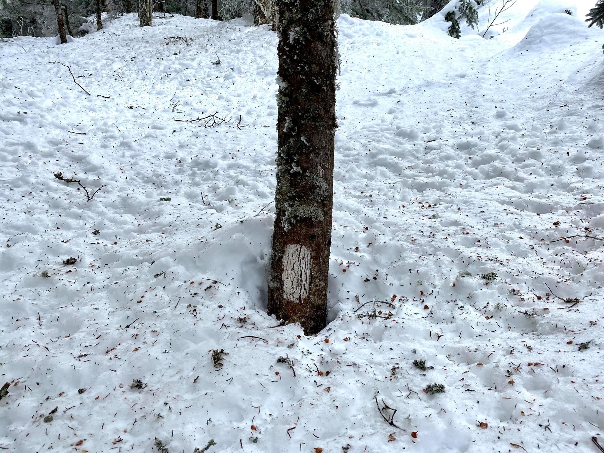
ended up off course 10-12 times total. Impossible to follow white blazes in the
open hardwoods covered with snow (2-3” fresh powder today). Additionally, the
“white” blazes were of various ages, & there was usually no distinguishable
footbed. From Burnt Mtn. to North Jay Peak col they looked to be fresh;
everywhere else they were older and/or of the nailed on, peeling scrap wood
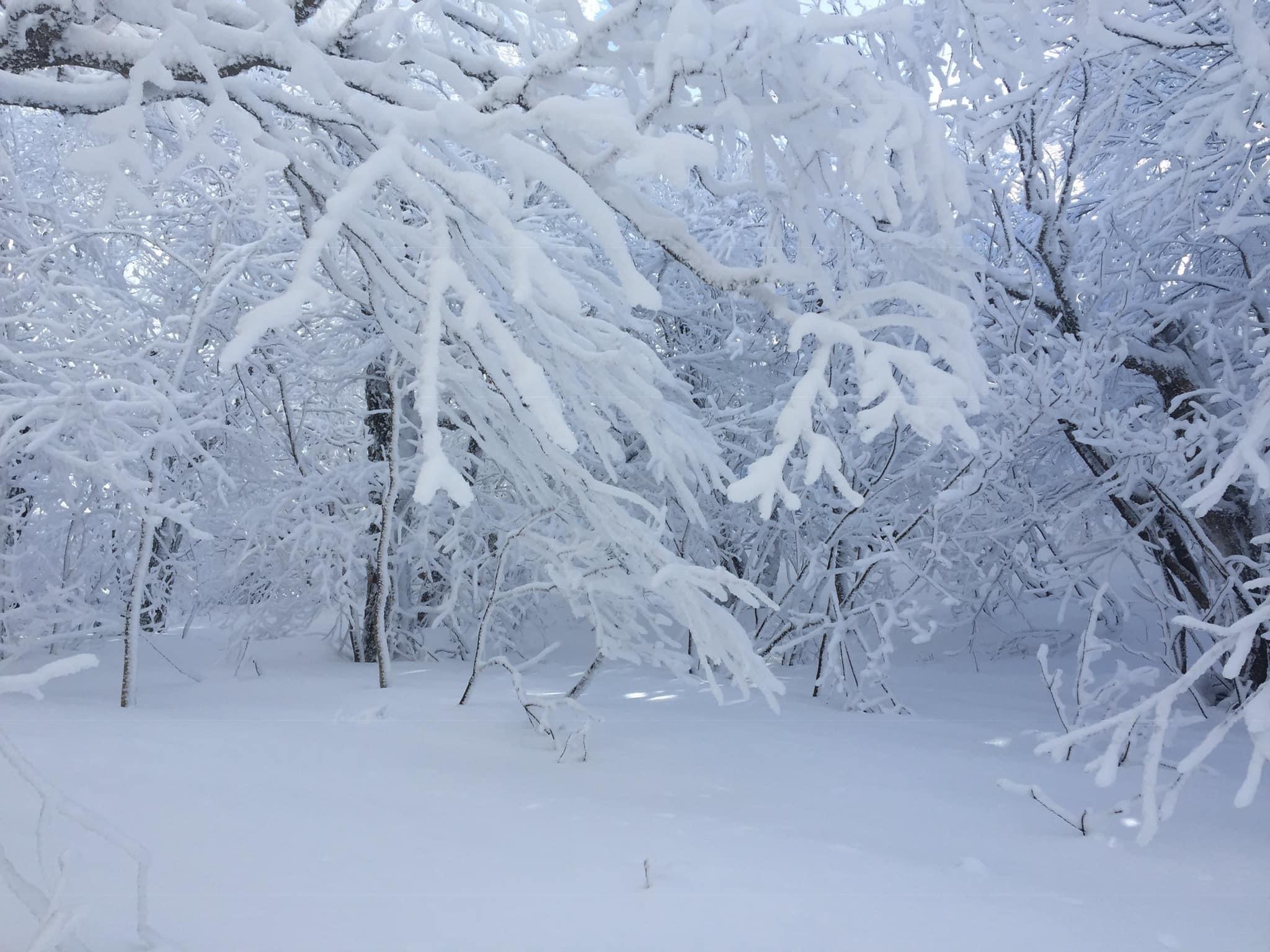
variety of blaze which, when it peels, turns into a brown blaze! The woods were
a spectacular winter wonderland, however, & I felt very happy. Around North Jay col I encountered an old set
of snowshoe tracks from possibly the day before. Oddly, they disappeared around
Doll Peak, never to be encountered again. On one of my “barely off-the-trail
excursions,” I somehow completely missed Laura Woodward Shelter & found
myself starting the climb up Jay Peak when I realized it. (So much for getting photos
of all the shelters!) The section of LT between ski trails was its usual crazy
steep & completely unbroken. Chris met me inside the tram station, I warmed
up for about ½ hour, & we hiked down to Jay Pass together. Chris lost his Santa
hat on the way down.
3. Thursday, December 27,
2018 – 7.8 miles (6.8 LT, 1 side)
Route
242/Jay Pass to Rt. 58/Hazen’s Notch & down to winter parking
Chris’s
Santa hat was hanging at the trailhead! 4-5” powder overnight made for a lovely
snowshoe with Chris up to Domey’s Dome. He turned back there. Usual challenge
following trail but not too bad until Buchanan Mtn. to Hazen’s Notch Camp area.
I say “area” because, again, I never saw the spur sign to the shelter amongst
the miles of open hardwoods covered in fresh snow. A real adventure staying on
trail which would have been impossible without my GPS track. Lots of tracks,
including moose tracks in the Buchanan Mtn. area +/- 1-2 miles. Wandered off trail many,
many times, but the woods are so open & beautiful it didn’t matter. Wow! At
the Notch, I took a left & walked exactly a mile to the winter parking area
where Chris was waiting.
4.
Thursday, December 26, 2019 – 11 miles (10 LT, 1 road)
Hazen’s Notch to Route 118
Chris dropped me off at Hazen’s Notch end of plowing, Lowell side around 7 am. Saw bear prints near the height of land & another couple of times this day. Had trouble following trail here and there; GPS to the rescue. Beautiful woods. Did not have the desire (or energy) to climb the extra 0.3 to Belvidere.Thankfully, trail from B down was broken out.
5.
Monday February 3, 2020 – 11.1 miles (9.6 LT, 1.5 side)
Route
118 to Davis Neighborhood Trail
Love
this section of trail! Encountered some ski tracks high on the ridge &
again closer to Corliss Camp, where Chris met me. Descended Davis Neighborhood
Trail. Found out he parked in the wrong spot because landowner left a note on
the car. Left reply of apology.
6.
Wednesday, February 5, 2020 - 14 miles
(12.5 LT, 1.5 side)
Davis Neighborhood to West Settlement Road
Enjoyed this day very much. The woods are gorgeous, albeit with some tricky route finding. Backcountry ski tracks here & there. Descending Laraway, I met Chris & we took a funny “Lilliputian” photo (he looked so tiny!) at the incredible, towering icicles. J
7.
Thursday, March 5, 2020 – 12 miles (8 LT, 3.5 side)
West Settlement
Road to Chilcoot Pass to Beaver Meadow parking.
First couple of miles were an easy warmup:
West Settlement Road is plowed as there is active logging going on, although I
did not see any of it save for a parked logging truck. LT then follows a
groomed VAST snowmobile trail for another 1/2 to 3/4 mile or so, more easy
walking. Barebooted.
LT makes an unsigned, abrupt right hand
turn off the VAST trail that is easy to miss - I just happened to look up &
see a white blaze off to my right. Snowshoes went on here & remained on
until the car. The snowshoeing was *perfect* & I floated along barely making
a dent in the solid but grippy surface. There were some older ski tracks along
this section as far as Bear Hollow Camp. The hardwoods were spectacular here!
Bear Hollow to Whiteface to Morse Mtn.,
about “4.5” difficult miles, did not look to have seen any traffic. (Last
sign-in at Whiteface Shelter was in November.) The climb & descent of
Whiteface get very steep, but snowshoeing conditions were absolutely stellar
this day so the going was not difficult. I lost the trail about a half dozen
times & resorted to GPS to get back on track. After Whiteface (aka Sterling) Mtn., staying on the LT
proper was a bit more challenging, but I eventually made it to Whiteface
Shelter, where Chris was waiting having come up from Beaver Meadow &
Whiteface Trail (“steep!!!”).
We continued on to Chilcoot Pass over some
sketchy, steep terrain & more challenging trail finding... “1.5 miles” my
ass!! Chilcoot Trail is very steep but fun & the footing was good this day.
A few more inches of powder would have made for an exciting butt slide! Nearing
Beaver Meadow Lodge we lost the trail, but the woods were open so we
bushwhacked the final quarter mile. On
the way out, we checked out the large Beaver Meadow which required a short BW.
Views of the Meadow, which is situated in a bowl, & surrounding ridges were
very fine. An easy couple of miles brought us back to the car.
8. Saturday,
March 7, 2020 - 7.8 miles (5.9 LT, 1.9 Smuggler’s ski trail)
Chilcoot Pass to
Rt. 108 via Smugglers Notch ski area
Paul Sulva joined me for the
day. We started off at Madonna II lift,
Smugglers Notch Resort, which has a very gracious uphill policy (6-8 am on
specific trails & no charge - thank you!!). Lower Chilcoot, Waterfall, &
Upper Chilcoot Trails brought us to Chilcoot Pass in about a mile. Easy going
with snowshoe televators!
The fun started here, with the LT hiding in
the woods & paralleling ski trails much of the first couple miles. Was
quite chilly & blustery atop Madonna Peak. Took a much appreciated break in
the heated ski patrol hut on top before continuing on. Next section to Sterling
Pond had more challenging trail finding & a steep, exaggerated side hill to
contend with. (Had I not been intent on the LT proper, paralleling ski trails
would have been tempting.)
Views from Sterling Pond were fantastic,
with the Mansfield Ridge sparkling in all her glory. From the Pond down to Rt.
108 is definitely not my favorite section: ongoing GPSing, crisscrossing skier
tracks, much tedious side hilling, & lots of up on the way down. Lower down
we finally encountered some welcomed snowshoe tracks & Chris, welcomed
because it meant we didn’t have to “think” anymore. Ha! We did the Barnes Camp Loop to finish the
section. Stopped by The Alchemist for some beverages, then Green Mountain
Club’s Winter Trails Day, where all 3 of us walked away with raffle prizes
(microspikes, lift tickets, & a T shirt)!!
9. Monday, March 9, 2020 – 11 miles (9.4 LT, 1.6 side)
Rt. 108 to Nebraska Notch & down to
Lake Mansfield
Having done the LT 5 times in non snow
months, I assumed this section would be the most technically challenging. Therefore, I brought
everything: snowshoes, spikes, crampons, ice axe, poles, & even a rope!
Taft Lodge had snow packed halfway up the front
door & completely covering the front deck. I did not go inside! Barebooted
to just below treeline, at which point there were a few diverging paths through
the spruce. Put snowshoes on after sinking into a spruce trap up to my hips.
Televators & ice axe came in handy on the very steep slope going up The
Chin, potentially quite a scary spot, but thankfully the slope was softer snow
and not ice. Winds on the ridge were
brisk & chilly, but the scenery was stellar! Lots of ski tracks up there.
Couple of confusing spots heading to The Forehead, GPS helpful. The Forehead
was spectacular but route finding was a bit tricky before taking the plunge
down to The Needles Eye.
This is the section I worried about
beforehand. There are 5 ladders & some tricky moves w/ big dropoffs. (There
is a “bad weather bypass,” but that is not the LT.) I switched from snowshoes
to spikes & gingerly made my way down. Some ice to negotiate, but crampons
& rope we’re not used. Much quicker than expected - & after seeing only
2 of the 5 ladders (the other 3 being buried in snow)!! - I was almost
disappointed to arrive at Needles Eye.
The next 3.5 miles to Taylor Lodge was a
lovely snowshoe through open hardwoods. An extra treat was the fact that this
section had been snowshoed over the weekend such that I did not have to do any
navigation. Yay! Chris met me at Taylor Lodge, & from there it was an easy
2.5 down to the car. There were a few bare, snow-free spots, but we opted to
keep snowshoes on until reaching the road.
Somewhat surprisingly, even though temps
hit the 50s, the snow was not overly sticky in our snowshoes. It was WARM... I
heard geese flying north, spied a couple of chipmunks who’d emerged from
hibernation, & saw fresh bear tracks! Happy to have finally done the full
Mansfield traverse in winter.
10.
Wednesday, March 11, 2020 – 11.6 miles
(9.1 LT, 2.6 side)
Lake Mansfield Trail
to Taylor Lodge to Duck Brook Trail to Bolton Notch Road
LMT was spikeable, but snowshoes went on
shortly after leaving Taylor Lodge when I started postholing every 10th step or
so. After a melt/rain/freeze, the surface is hard, uneven, sometimes ice
glazed, crunchy, & LOUD w/ plastic MSR snowshoes!! There is a lot of snow
up high, with blazes just peeking out above the snow near Bolton Mtn. Snowshoes
are necessary & will be so for a few more weeks.
Bolton Mtn. had a stretch of maybe 3/4 mile
that was badly postholed & difficult to maneuver around. Thankfully the
culprits descended one of the connectors to Bolton Valley ski area. LT was the usual GPS-aided search for white
blazes but was a little bit easier to follow than previous sections... but
still not easy. Some beautiful woods & interesting “nooks & crannies” up
there, especially in the Clark-Mayo area. Tons of moose tracks &
nuggets around Mt. Mayo! Duck Brook Trail got muddy towards the bottom, with
lots of rotting snow. Finally removed the snowshoes in the last half mile.
Didn’t see another soul all day, true of
most days on the LT in winter.
11.
Thursday, March 12, 2020 – 8.6 miles (7.7 LT, .9 side)
Duck Brook Trail
to LT south across Oxbow Ridge, across Winooski River, to Bamforth
Ridge trailhead
Today was an extra treat because the crust
was firm enough to support my weight. Carried snowshoes but never needed them.
I reclimbed Duck Brook Trail, yesterday’s descent/exit for a mile, then headed
south on the LT. This section of trail is a relatively new (2015) relo & is
a truly beautiful 4-5 mile ridgewalk through a forest of open hardwoods. It is now
one of my favorite sections of the LT. Some interesting blazing up on the ridge
- lots of dripping, “weeping” (drippy paint) blazes. Trail was MUCH easier to follow than
expected. Used GPS track only a couple of times today!
As I descended in elevation - from ~2000 to ~400
feet on a predominately south-facing slope, the snowmelt was pronounced. The
last 4 miles included crossing the Winooski, a road walk, a smaller river ford,
& a flat walk through farm fields complete with stiles. There was so little
snow that it felt like cheating to call it a winter hike. Preston Brook
required an invigorating ford, & my feet got soaked. Water was ankle to mid
shin deep. There is a high water bypass, but I had only a mile to go &
wanted to stay on the official LT. Actually
met 2 humans & 4 dogs during today’s hike, only the 2nd & 3rd hikers I
have met in 90 miles of the LT in winter.
12. Saturday,
March 14, 2020 – 9.8 miles (8.1 LT, 1.7 side)
Bamforth Ridge TH
to Montclair Glen & down Forest City Trail
Carried snowshoes but lucked out and was
able to microspike the entire hike today without postholing. A little bit of
tricky route finding through open hardwoods about 1/2 mile above Bamforth Ridge
Shelter. Some loose "ice balls" coming off the south side of the Hump
required careful foot placement. From
Canada to Duxbury Road I have met 3 hikers. On a Saturday on Camel's Hump, I encountered 16.
13. Sunday, March
15, 2020 – 12.3 miles (10.6 LT, 1.7 side)
Forest City Trail
to Montclair Glen to Appalachian Gap
Hiked back up yesterday's descent trail,
Forest City, & headed south. Faint, old tracks were helpful for the first
mile of the LT, to Mt. Ethan Allen. From this point to Birch Glen Camp, about 8
miles, route finding required constant vigilance & frequent GPS & map
referencing in order to stay on trail. The
section between Ethan Allen & Burnt Rock Mountain is difficult, with many
little steep & potentially sketchy ups & downs, challenging route
finding, & "3 miles that hike like 6." There is a long sidehill
from hell going around Mt. Ira Allen that I won't soon forget. (Thankfully I
was not snowshoeing this day.) In spots an ice axe would not have been
overkill.
Ladder Ravine was somewhat anticlimactic
because the lower half of the aluminum ladder was completely buried in snow
such that only the top 7 (icy!) rungs needed climbing. At the top of the
ladder, there was a leaning tree that must be crawled under, an awkward move to
say the least. Actually met 3 hikers
on spectacular Burnt Rock Mountain, they having ascended Hedgehog Brook Trail
(one of my potential bailout routes!), & for 1/2 mile I didn't have to look
for the trail. Many beautiful exposed, dry ledges here!
Despite my whining about route finding,
this entire LT section is absolutely gorgeous in winter - much open hardwoods,
downright gentle terrain between Hedgehog Brook Trail & Birch Glen, &
with almost boilerplate conditions, I was able to microspike the entire day! I
still carried snowshoes, however, because there is a lot of snow that could get
reeeal soft this time of year. After
Birch Glen Camp was a 1000 foot climb of Molly Stark; then a smaller climb of
Baby Stark followed, unfortunately, by deep, frozen, awkward postholes in the
last mile to App Gap.
14. Wednesday,
March 18, 2020 – 13 miles (11.6 LT, 1.4 road)
Appalachian Gap
to Lincoln Gap Road & down East side
Escaped the Covid craziness to my happy
place for a lovely stroll on the Long Trail from App Gap to Lincoln
Gap. With consolidated, crusty snow
& lots of prior snowshoe & ski traffic, I was able to spike the entire
route this day. Almost felt like cheating to call this a winter hike, but as
Miriam Underhill proclaimed so many years ago, “winter” is defined solely by
the calendar & not by conditions.
After the first couple of miles with its
intermittent very steep scrambles, the rest of this traverse is rather gentle
undulations with frequent viewpoints & ski trail crossings of Mad River
Glen, Sugarbush, & Sugarbush North. The ski areas were closed due to the
pandemic; however, a couple of trails were groomed this day - one near the
summit of Ellen, the other by Castlerock. Met
5 skiers & 18 hikers today, everyone looking happy & keeping appropriate
distances. Saw a few dogs, including one naughty spaniel whom we guided back down
Mt. Abe to his person after calling the phone number on his collar.
This is my last LT section for this winter.
I am at mile 120 with 150 to go next winter, god willing & the creek don’t
rise...
15.
Friday, January 1, 2021 – 18.7 (17.3 LT, 1.4 road)
Lincoln Gap to
Middlebury Gap
Vermont version
of a Presi Traverse. Picked up where I left off before end of Calendar Winter last
March. Lucked out with minimal snow depths. ~1.5 mile/1000 foot climb to Lincoln Gap went quickly.
Lots of foot traffic & only an inch or two of snow. LT South was well
travelled to Sunset Ledge, & there was one old set of human prints to
Cooley Glen Shelter.
From CG Shelter to Clark Brook Trail it was
just critter tracks - coyote, bobcat, moose, partridge, vole, squirrel, &
rabbits... SO many rabbits! I learned to trust the coyotes - they apparently
really like the LT, & I resorted to checking my GPS in only two
questionable spots this day, definitely a rarity for the extremely
hard-to-follow LT in winter. Because of so little snow, I also was able to
discern the trail depression which was very helpful in the many open hardwood
sections.
Barebooted the first 3-4 miles, but ice
underfoot was well hidden so I finally threw on the spikes & wore them the
rest of the day. A few tricky ice bulges here & there but nothing too
crazy. Only spot snowshoes may have helped a little bit was going over Mt.
Wilson, which held the deepest snow of the day & some drifts, but it would
not have been worth schlepping them that far for so little benefit.
Two people had come up Clark Brook Trail
for Wilson; one other guy had hiked north from Middlebury Gap to Roosevelt.
This made me happy since I could merely follow his footsteps & no longer had
to think about where the trail was!
16. Monday,
January 4, 2021 – 9.9 miles (all LT)
Middlebury Gap to
Brandon Gap
Some bareboot traffic through Middlebury
Snow Bowl to Worth Mtn., then just wildlife tracks. With a few inches of fresh
snow, I found it easier to wear snowshoes; plus I like leaving nice tracks. A
bit of tricky & challenging route finding in the extensive hardwoods. Used
GPS maybe 10 times. Also followed coyote & fox tracks - they like staying
on the LT. Chris hiked back to meet me a couple of miles from the end. After Mt. Horrid it was too bony for snowshoes,
so I switched to spikes. Visited the awesome Great Cliffs of Mt. Horrid on the
way out. No peregrines in winter so they were accessible.
17. Wednesday,
January 6, 2021 – 19.9 miles (all LT)
Brandon Gap to
Route 4/Sherburne Pass
First 4 miles, to Bloodroot Gap, were broken
out by backcountry skiers. From Bloodroot Gap to Tucker Johnson Shelter, almost
15 miles, I broke trail through 4-5” which turned out to be a perfect
depth/effort for this solo effort. Paint
blazes (white - haha) are much more frequent than they were to the north. Still
I resorted to GPS maybe a dozen times due to extensive snow-plastered open
hardwoods. The LT in winter is a challenge for sure! In this section the LT
goes over no actual summits but traverses around them, sometimes on a pretty
tricky sidehill. Ankles got a workout. It is a beautiful section, with more
views in the winter months.There is once again a shelter at Tucker Johnson (old
one burned down a few years ago). A thrill to reach Maine Junction today but
saddened to hear shocking news of the capitol insurrection.
18. Friday,
January 8, 2021 – 14.2 miles (all LT)
Route 4 to
Keiffer Road
Snowshoes car to car. Route 4 to Cooper
Lodge had been alternately barebooted or skied. Snow depth up high on the ridge
- Jungle Junction/Pico to Killington to Little Killington - provided perfect
snowshoe conditions. No one had been past Killington Spur. Winter wonderland up
there! Some searching for the trail here & there. White blazes on
snow-plastered trees again: joy! GPS to the rescue.
Approaching Governor Clement Shelter, I
encountered a bareboot track for maybe a mile which made route finding easy. From
Governor Clement to Keiffer Road was lower elevation & had just enough snow
to snowshoe although they were not absolutely necessary. Some beautiful hemlock
forests & big pines in there! Saw an amazing otter track next to an
old cellar hole. Other than 3 skiers at
Cooper Lodge, I had the entire 14 miles to myself.
19. Sunday,
January 10, 2021 – 15.5 miles (14.7 LT, .8 side)
Wallingford Pond
Trailhead to Keiffer Road
I wanted to make this next section a bit
longer than the obvious road-to-road 10 miles. Studying the map, it appeared
that one could get very close to the LT/AT by utilizing a snowmobile (VAST)
trail & a short bushwhack from Wallingford Pond Trailhead. This was,
indeed, the case. I clocked .83 mile. Yay.
While there are no big mountains in this
section, there were some stiff little climbs: Beacon Hill, the climb out of
Clarendon Gorge, Bear Mtn., & White Rocks. Some of the section was
untouched snow, some had been traveled by 1-2 people, & some short sections
(Clarendon Gorge, White Rocks) were a packed super highway. Section up/over
Bear Mtn. was full of bent-over, snow-encased saplings & branches for maybe
a mile. That was the main route-finding challenge of the day, but it helped
that one person had gone through a day or two before. I mostly wore spikes but did about 3 miles in
snowshoes & carried ‘em the rest of the day. SO many animal tracks on this
gorgeous day!
20. Wednesday,
January 13, 2021 – 17.3 miles (15.9 LT, 1.4 side)
Wallingford Pond
to Mad Tom Notch
Started off in spikes for the 0.4 mile
snowmobile trail & 0.4 mile easy bushwhack to the LT, coming out at the
exact point as 3 days prior. Stayed in spikes until Big Branch, where the snow
was a bit deeper & slightly postholed. Switched to snowshoes at that point
& kept them on to the end; they were not absolutely necessary, but they
usually allowed for easier walking & better grip, & I’d rather wear
them than carry them.
Trail is much, much easier to follow than
most LT sections north of here. Still, even though I have end-to-ended the LT 5
times, I spaced out & went the wrong way coming off Baker Peak, via the
more traveled Baker Peak Trail. After losing a couple hundred vertical feet
& maybe 0.3 mile, I looked up & thought “Why is that blaze blue &
not white?” Hahaha! I turned around & reclimbed to the LT/AT junction
laughing at my dumb mistake.
Little Rock Pond & Griffith Lake are
lovely in wintertime! Snow was noticeably deeper on Peru & Styles Peaks, as
expected (elevation 3400 feet), & I was very happy for my snowshoes. I
encountered many critter tracks but exactly zero humans in 18 miles which made
me happy.
21. Friday,
February 12, 2021 – 6.5 miles (5.5 LT, 1 road)
Mad Tom Notch to
Rt. 11/30
After a month off
the LT & a couple feet of snow accumulation, I used my next section of the
LT southbound as a sort of reconnaissance hike to determine snow depths in the
southern part of the state. Because I knew I’d be breaking trail, Chris let me
wear his bigger Tubbs snowshoes which floated marvelously. Last time I finished my hike
at Mad Tom Notch, we were able to drive all the way to the Trail crossing. Not
so this day. Had to park at the winter lot about a mile east & walk up the
snowmobiled road. Once on the LT, I followed an old snowshoe track now &
then, but there was a lot of wandering & I preferred to find my own trail.
There were A LOT of bent over, snow-laden saplings & branches, a few
blowdowns, & old faded blazes making staying on trail a challenge. GPS
track to the rescue once again.
Happy to reach the summit of Bromley &
lots of skiers, and shortly thereafter Chris, who hiked up to meet me. The 3
miles from Bromley to the finish were more traveled, with a few barebooter
holes (boo). We smoothed it out to a beautiful snowshoe track.
22. Wednesday,
March 3, 2021 – 14.4 miles (10.8 LT, 3.6 side)
Kelly Stand Road
to North Brookwood Road & Rt. 11/30 to Old Rootville Road
Spiked up to
summit of Stratton via LT northbound. Trail heavily traveled & firmly
packed. Switched to snowshoes on summit. Lots of bent over branches &
snow/ice encased trees at higher elevations, a couple of which required
hands-and-knees crawl unders.
Coming off summit there was an old,
infrequently discernible, meandering snowshoe track, & footing was over a
surface of hard frozen ice chunks. Tubbs snowshoe dropped a cotter pin &
ring which attaches the snowshoe claw to the plastic bed. MacGyvered a fix with
a key ring, alas the fix got me only a couple miles to the IP road/ VAST Trail
7. Fuuuuck!! One bar on my phone & Chris to the rescue – yay! Trail 7 to
7A to a local trail that leads to North Brookwood Road which I remembered from
skiing the Catamount Trail.
Chris picked me up & shuttled me around
to the LT/AT crossing on 11/30. In order to make the most of the day, I
traversed the 5-mile Spruce Peak section (spikes to the shelter spur, easy
trail breaking in spare snowshoes from there to Prospect Rock), down Old
Rootville Road, which is snowmobiled.
23. Friday, March
5, 2021 – 10.4 miles (6.8 LT, 3.6 side)
North Brookwood – Stratton Pond – Old Rootville Road
Connected to Long Trail via the local trail off North Brookwood Road and VAST Snowmobile Trails 7A and 7. Snowshoes once on the LT. Looked like no one had been on LT north of Stratton Pond for a long time. This whole section could actually have been skied. Trail breaking was easy peasy - I sank in only 2-4” the entire solitary ~7 miles to the William B. Douglas Shelter junction, where Chris met me. We continued on the LT, which is also a groomed snowmobile trail here, to Prospect Rock & down Old Rootville Road. Sections of LT in open hardwoods are hard to follow. GPS used a few times in order to stay on trail.
24. Saturday,
March 6, 2021 – 16.5 miles (14.3 LT, 4.2 side)
Rt. 9 to the MA
border, AT to Route 2 in North Adams.
Spiked steeply up Harmon Hill at O’dark
thirty. Trail was rather treacherous - hardpacked, icy, postholed, & in the
dark to “boot.” Extra care was taken to not trip here because the slope was
very steep & glazed w/ ice. On Harmon Hill in time for sunrise, I switched
to snowshoes. Trail breaking was not difficult; I sank 3-4” usually, more
occasionally. Followed a meandering
track on & off 2 miles to Congdon Shelter, then was thankfully on my own.
Consulted GPS 15-20 times when trail was hard to follow in open hardwoods. (The
entire 18+ miles is open hardwoods!!) Actually met a northbounder near
Consultation Peak but ended up rarely following his tracks because he was off
trail more than on it.
Happy to finally reach the Massachusetts
State Line, where Chris had hiked to meet me, up from the AT in North Adams. :)
We switched back to spikes at Pine Cobble Junction - trail was pocked with
frozen postholes - & descended the AT to North Adams. I didn’t remember all
that mountain laurel there, but it was gorgeous!! For something different, we
took the bad weather bypass. Designated parking area on Route 2 in North Adams
was much appreciated.
25. Monday, March
8, 2021 – 22.6 miles (all LT)
Route 9 to Kelly
Stand Road
Didn’t want to spend the night out so opted
to bite off this entire 23-mile section in a day with a 3 am start in the
Glastenbury Triangle(!). Spiked it steeply up to Melville Nauheim Shelter spur.
Snowshoes from that point on for the rest of the day. The snowshoeing was
great, sinkage only 3-4” usually. (When soloing, it pays to be patient & wait
for the deep snow to consolidate.)
Beyond Maple Hill there was one set of
tracks from the same guy I met 2 days before south of here. He wandered off
trail a lot; I tried to stay on the trail & utilized my GPS A LOT. Trail is
very difficult to follow as it is through mostly open hardwoods, & the
white blazes are inconsistent. Some are newer; most are old & faded. Not to
complain but to warn. “The LT is not designed for winter travel” says the
guidebook. I can confirm. Trail is especially hard to discern from Little Pond
Mtn., over Glastenbury, to Kid Gore Shelter, but oh, what beautiful hardwoods!
I took off my snowshoes in order to climb
Glastenbury’s fire tower. Unbeknownst to me, there is a snowmobile trail that
goes right to the summit, & I crossed 3 or 4 more snowmobile trails over
the course of the section. Was a bit more foot traffic in the last 3.5 miles,
from Story Spring Shelter to Kelly Stand Road, but I kept snowshoes on.
This was my final section to complete the
Long Trail end-to-end in winter, per GMC contact (Kristin McLane) the 11th
known person to do so. It took 25 separate day hikes (no overnights), 90% solo,
over the past 3 winters & is one of the hardest things I’ve ever done.


